
Discovering Plate Boundaries has been selected for inclusion in the Reviewed Collection of the Digital Library for Earth System Education (DLESE)! An article about Discovering Plate Boundaries was published in January 2005 in the Journal of Geoscience Education. Click to download the article. |
|
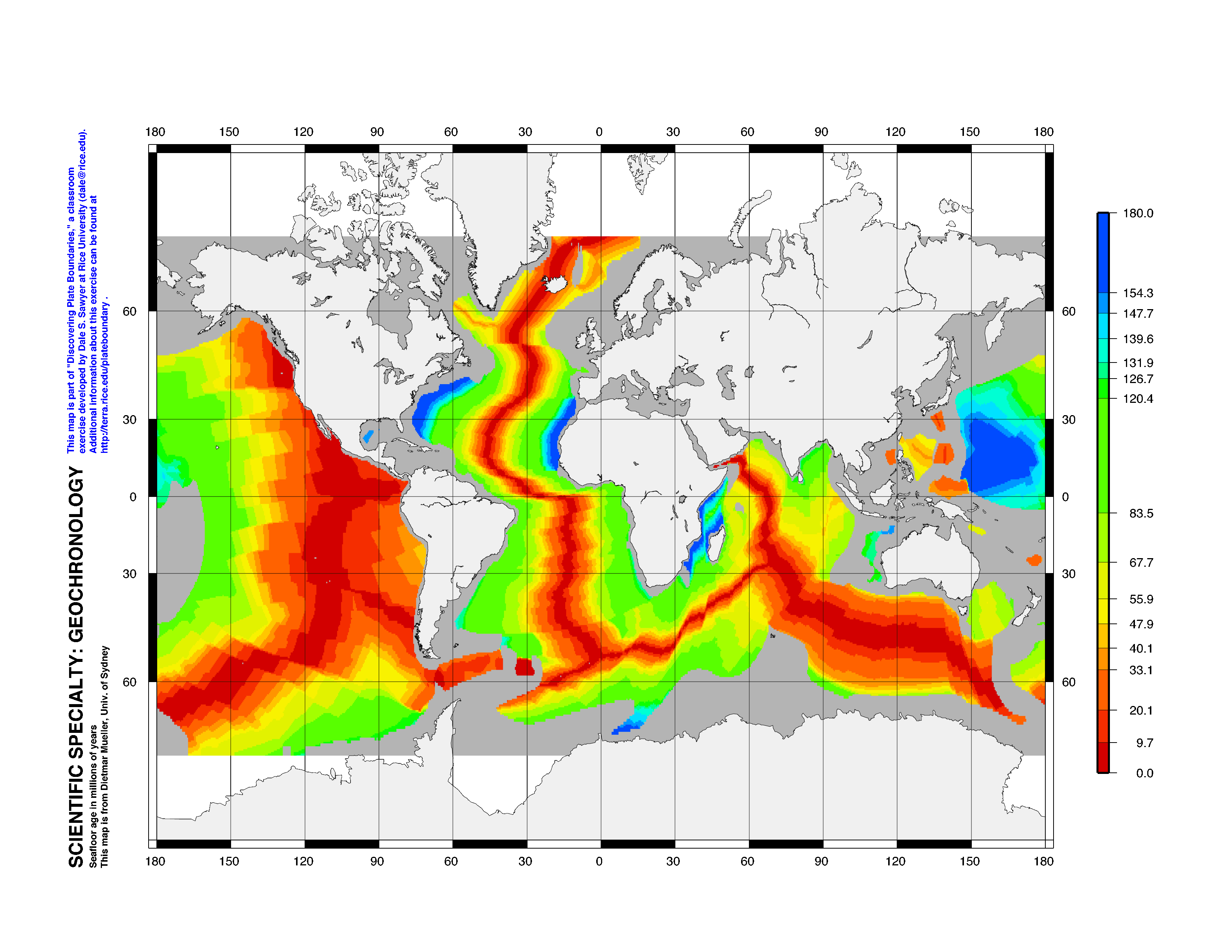
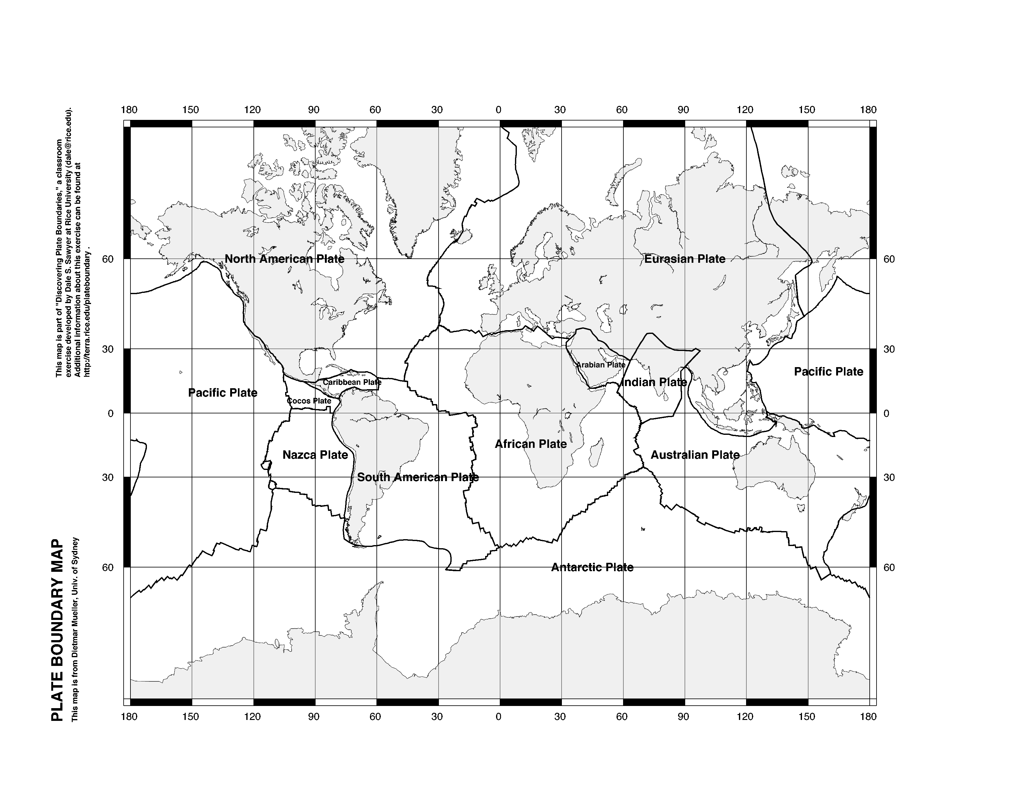
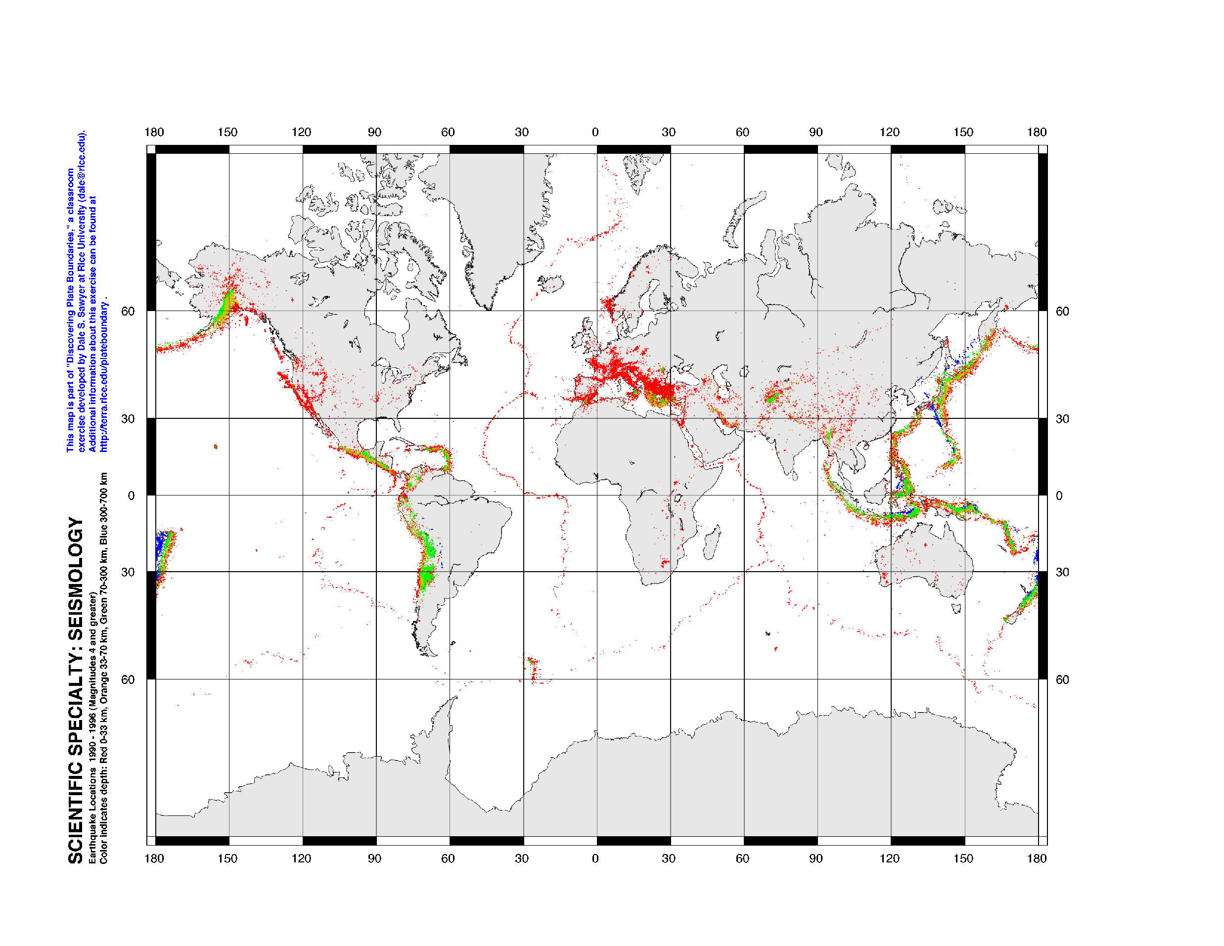
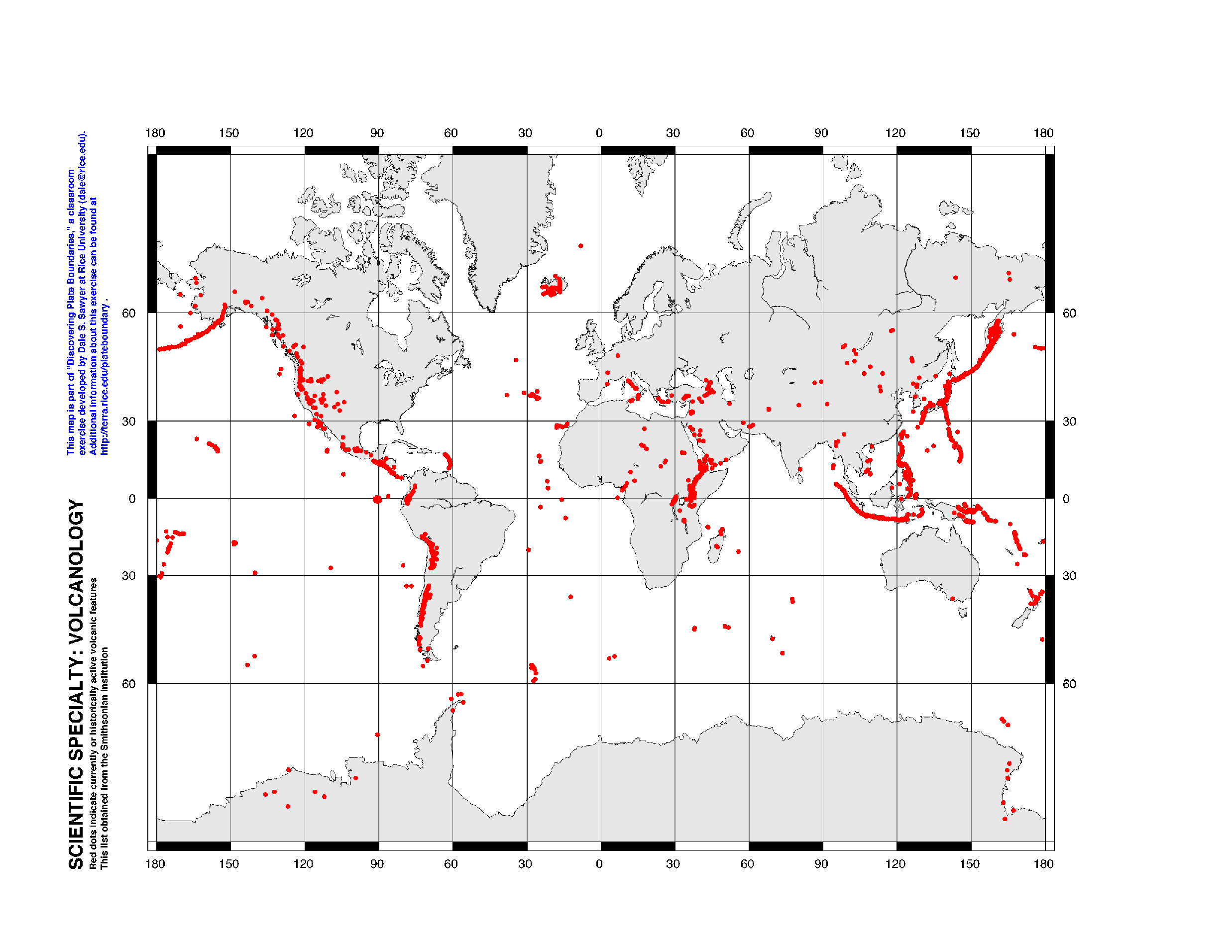
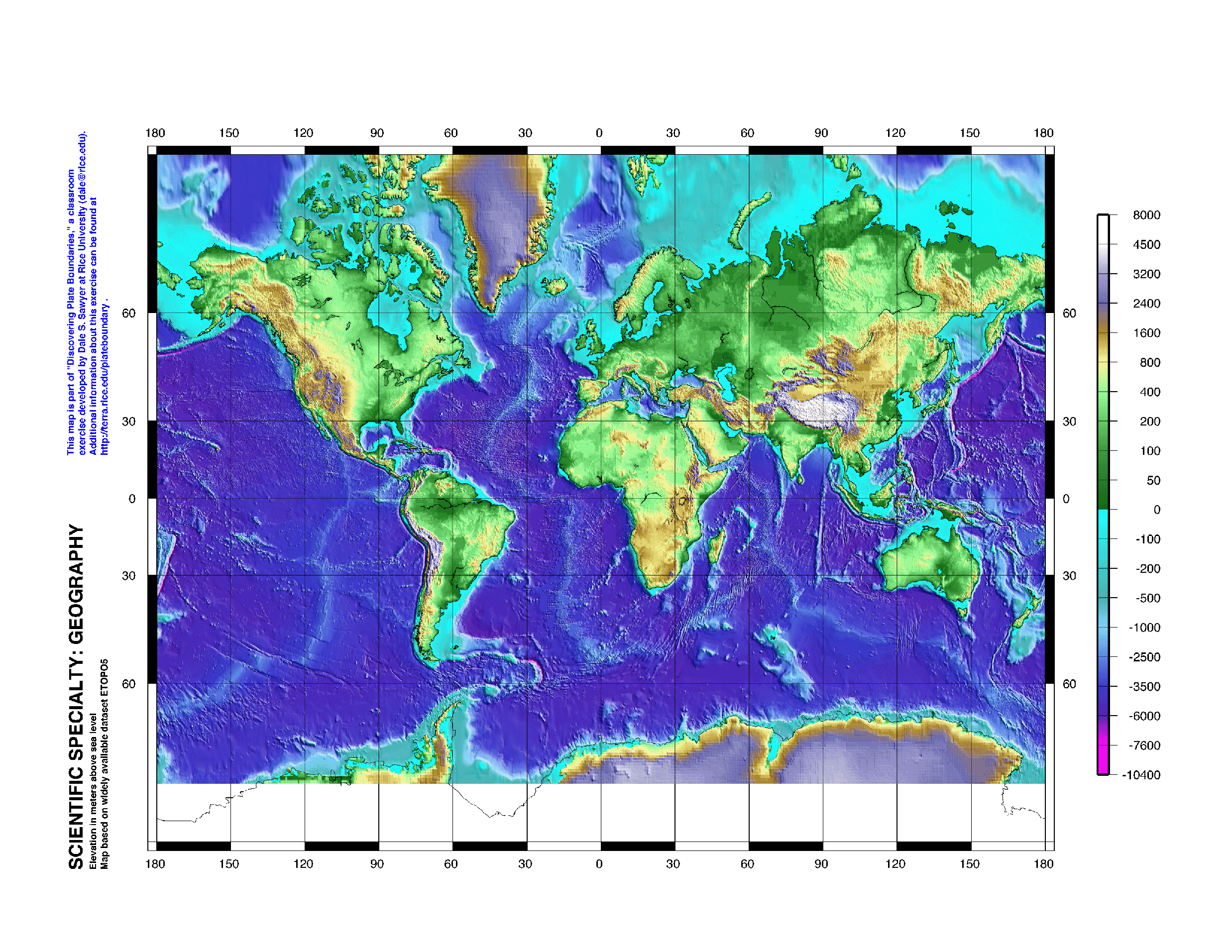
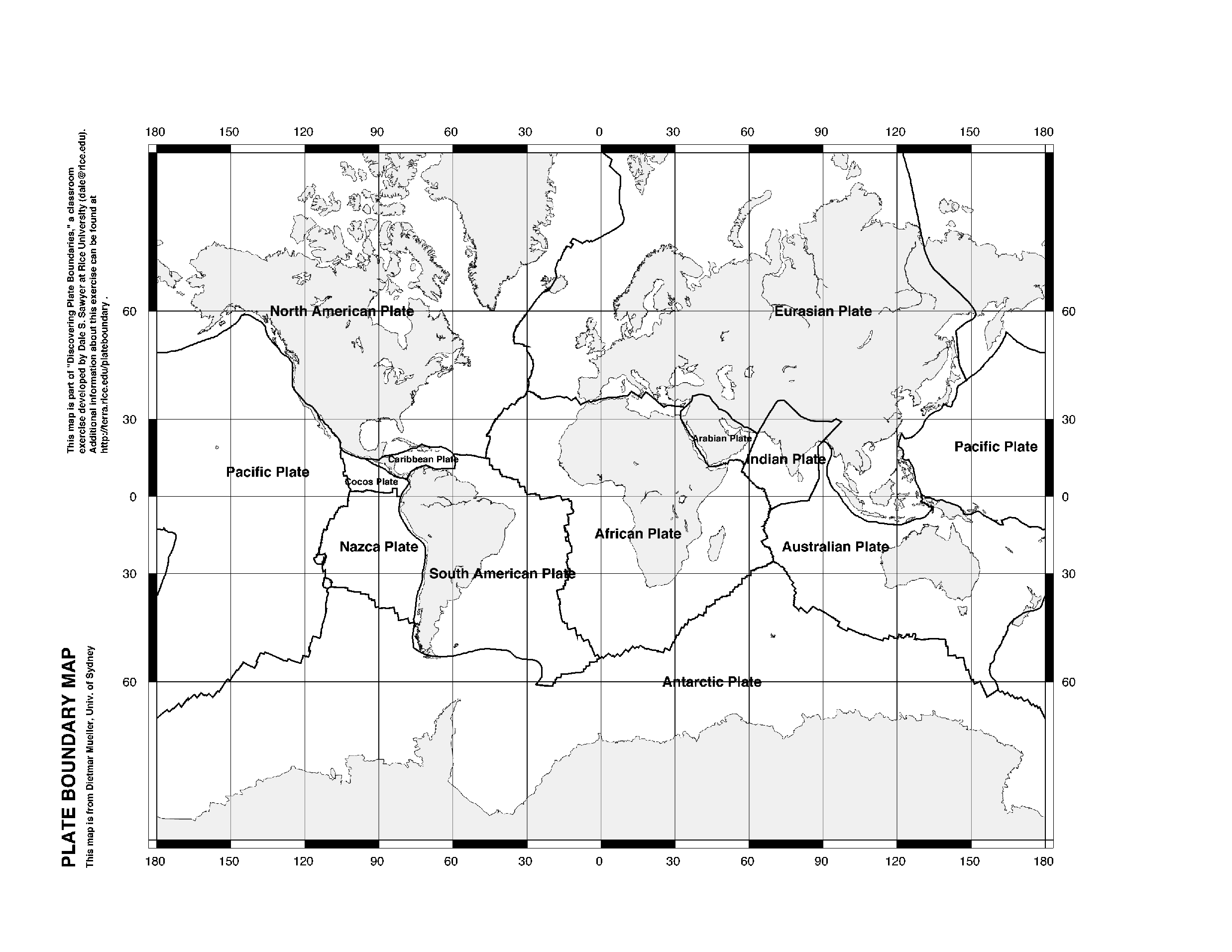
DownloadsAll materials created for DPB may be downloaded freely for classroom use. Copyright of all these materials remains with Dale S. Sawyer. Please drop me an email with your comments when you use the materials. Please acknowledge the source when you use the materials in any manner. MapsPDF format requires Adobe
Acrobat Reader which can be downloaded free.
Student Handouts
Wrap-up Overhead Transparencies (in PDF format)Set of 16 transparencies in 1 file Individual transparencies |
Home | Quick Start | Teachers Guide | Downloads | Order Kit | Resources | Presentations | Contact Us
Comments? E-mail dale@rice.edu
Last updated 31 July 2015